Data
- Obtaining
- Supplying
- High-Frequency
- Bottom Pressure Records
- Other Long Records
- GLOSS/ODINAFRICA Calibration Data
Donate
Donate to PSMSL
Data Notes
- Individual Station Data and Plot Notes
- Referencing the Data Set
- PSMSL Help File
- 2010 Changes to the PSMSL Data Files
Extracted from Database
20 Jul 2026
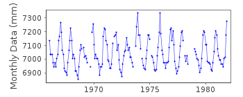
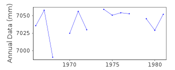
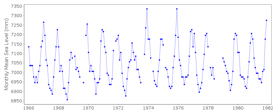
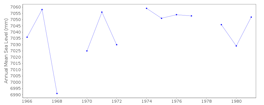
Station Information
| Station ID: | 1183 |
| Latitude: | 1.266667 |
| Longitude: | 103.85 |
| GLOSS ID: | 44 |
| Coastline code: | 555 |
| Station code: | 1 |
| Country: | SINGAPORE |
| Time span of data: | 1966 – 1981 |
| Completeness (%): | 92 |
| Date of last update: | 26 May 1988 |
| Green Arrow: | Current Station |
| Yellow Marker: | Neighbouring RLR Station |
| Red Marker: | Neighbouring Metric Station |
Please note: In many cases, the station position in our database is accurate to only one minute. Thus, the tide gauge may not appear to be on the coast.
Tide Gauge Data
Additional Data Sources (guide to additional data sources)
Fast Delivery Data from UHSLC station 699: hourly and dailyResearch Quality Data from UHSLC station 327: hourly and daily
Research Quality Data from UHSLC station 699: hourly and daily
Research Quality Data from UHSLC station 337: hourly and daily
Station Documentation
Link to RLR information.Documentation added 1991-06-11
Victoria Dock 555/001 RLR(1981) is 9.7m below Brass PlateDocumentation added 1993-07-12
Victoria Dock 555/001 RLR(1981) is 9.7m below Brass PlateDocumentation added 1994-07-12
Replaced by Keppel HarbourData Authority
Maritime Port Authority of SingaporeHydrographic Department
460 Alexandra Road, PSA Building
#20-00 Singapore 119963

![]()
![]()
![]()
