Data
- Obtaining
- Supplying
- High-Frequency
- Bottom Pressure Records
- Other Long Records
- GLOSS/ODINAFRICA Calibration Data
Donate
Donate to PSMSL
Data Notes
- Individual Station Data and Plot Notes
- Referencing the Data Set
- PSMSL Help File
- 2010 Changes to the PSMSL Data Files
Extracted from Database
21 Jul 2025
Station Information
| Station ID: | 1162 |
| Latitude: | 23.1 |
| Longitude: | -82.466667 |
| GLOSS ID: | 215 |
| Coastline code: | 930 |
| Station code: | 16 |
| Country: | CUBA |
| Time span of data: | 1966 – 2024 |
| Completeness (%): | 82 |
| Date of last update: | 18 Jul 2025 |
| Green Arrow: | Current Station |
| Yellow Marker: | Neighbouring RLR Station |
| Red Marker: | Neighbouring Metric Station |
Please note: In many cases, the station position in our database is accurate to only one minute. Thus, the tide gauge may not appear to be on the coast.
Tide Gauge Data
Additional Data Sources (guide to additional data sources)
Research Quality Data from UHSLC station 239: hourly and dailyStation Documentation
Link to RLR information.Documentation added 2002-10-23
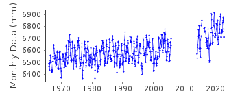
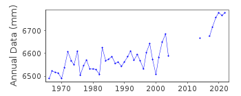
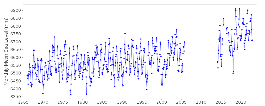
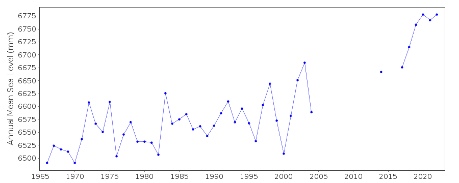
Siboney 930/016 RLR(1994) is 8.394m below TGBMThe tide gauge at Siboney was seriously damaged by hurricane Wilma last data is that for October 2005.
Documentation added 2016-04-28
The tide gauge at Siboney has now been re-instated.Documentation added 2016-06-29
Using information recently supplied from Cuba the tide gauge sensors are from 1966 a float recording hourly from 2014 a radar with 6 minute frequency and from 2016 a pressure sensor with 6 minute frequency.Documentation added 2020-02-06
Historical benchmark information and their relationship to TGZ has been supplied by the Cuban National Tidal Service as follows until 2000 the Primary benchmark was MAR-1 1.2529m above TGZ this was destroyed in 2000. During 2001-2005 Primary benchmark was 023037 1.5207m above TGZ . The station was destroyed by hurricane Wilma in 2005.The gauge was reinstated in 2014. Current Primary benchmark is SIBO-G 2.829m above TGZ.
Data Authority
Cuban National Tidal ServiceCalle 4 No. 304, E/3 Y 3-a
Playa
Cuidad Habana

![]()
![]()
![]()
