Data
- Obtaining
- Supplying
- High-Frequency
- Bottom Pressure Records
- Other Long Records
- GLOSS/ODINAFRICA Calibration Data
Donate
Donate to PSMSL
Data Notes
- Individual Station Data and Plot Notes
- Referencing the Data Set
- PSMSL Help File
- 2010 Changes to the PSMSL Data Files
Extracted from Database
13 Jul 2026
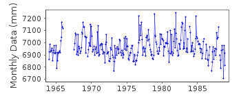
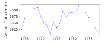
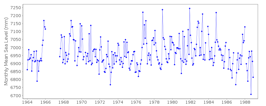
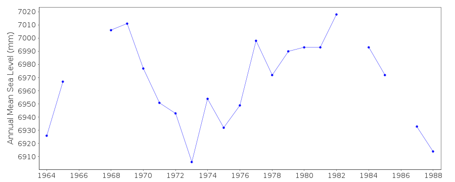
Station Information
| Station ID: | 1078 |
| Latitude: | 47.133333 |
| Longitude: | -2.25 |
| Coastline code: | 190 |
| Station code: | 113 |
| Country: | FRANCE |
| Time span of data: | 1964 – 1988 |
| Completeness (%): | 91 |
| Date of last update: | 07 Sep 1990 |
| Green Arrow: | Current Station |
| Yellow Marker: | Neighbouring RLR Station |
| Red Marker: | Neighbouring Metric Station |
Please note: In many cases, the station position in our database is accurate to only one minute. Thus, the tide gauge may not appear to be on the coast.
Tide Gauge Data
Station Documentation
Link to RLR information.Documentation added 1991-06-11
Pointe St Gildas 190/113 RLR(1979) is 17.5m below BM NGFOSK326BISDocumentation added 1993-07-12
Pointe St Gildas 190/113 RLR(1979) is 17.5m below BM NGFOSK326BISDocumentation added 2012-03-29
Last data received from Pointe St. Gildas is that for 1988.Data Authority
SHOM13 rue de Chatelier
29200 BREST

![]()
![]()
![]()
