Data
- Obtaining
- Supplying
- High-Frequency
- Bottom Pressure Records
- Other Long Records
- GLOSS/ODINAFRICA Calibration Data
Donate
Donate to PSMSL
Data Notes
- Individual Station Data and Plot Notes
- Referencing the Data Set
- PSMSL Help File
- 2010 Changes to the PSMSL Data Files
Extracted from Database
20 Jul 2026
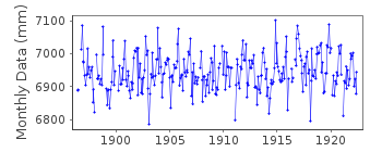
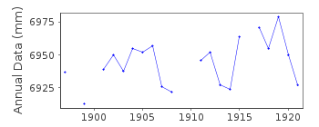
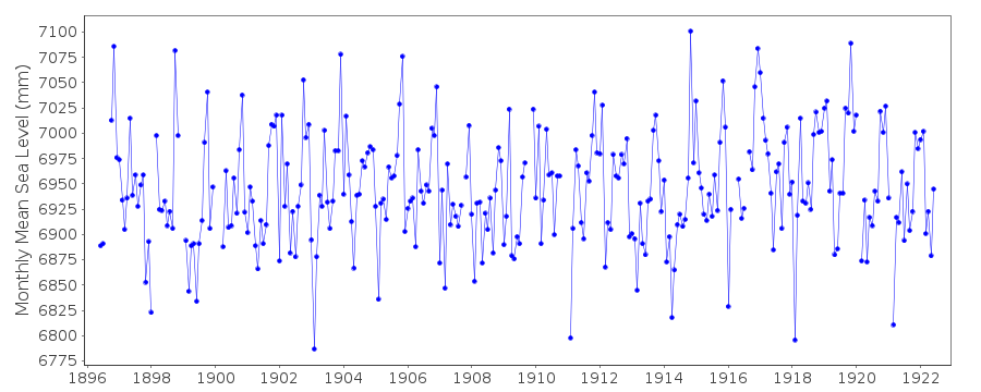
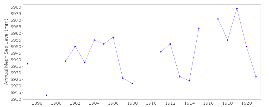
Station Information
| Station ID: | 107 |
| Latitude: | 38.133333 |
| Longitude: | 13.333333 |
| Coastline code: | 260 |
| Station code: | 11 |
| Country: | ITALY |
| Time span of data: | 1896 – 1922 |
| Completeness (%): | 91 |
| Date of last update: | 01 Jan 1980 |
| Green Arrow: | Current Station |
| Yellow Marker: | Neighbouring RLR Station |
| Red Marker: | Neighbouring Metric Station |
Please note: In many cases, the station position in our database is accurate to only one minute. Thus, the tide gauge may not appear to be on the coast.
Tide Gauge Data
Additional Data Sources (guide to additional data sources)
Nearby Real Time Stations from VLIZ: PA07Station Documentation
Link to RLR information.Documentation added 1991-06-11
Palermo 260/011 RLR(1919) is 7.7m below BMPalermo is an historic station. Last data 1922
Documentation added 1992-08-06
Italian levels may be influenced by the Messina Earthquake of 1908 - See Bottari et al.,Tectonophysics, 202, 269-275, 1992No BM information but data seems homogenous
Data Authority
Istituto Idrografico della MarinaPasso Osservatorio 4
16134 Genova

![]()
![]()
![]()
