Data
- Obtaining
- Supplying
- High-Frequency
- Bottom Pressure Records
- Other Long Records
- GLOSS/ODINAFRICA Calibration Data
Donate
Donate to PSMSL
Data Notes
- Individual Station Data and Plot Notes
- Referencing the Data Set
- PSMSL Help File
- 2010 Changes to the PSMSL Data Files
Extracted from Database
11 Mar 2024
Station Information
| Station ID: | 724 |
| Latitude: | 1.466667 |
| Longitude: | 103.833333 |
| Coastline code: | 555 |
| Station code: | 51 |
| Country: | SINGAPORE |
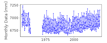
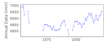
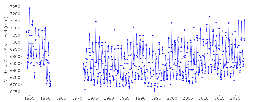
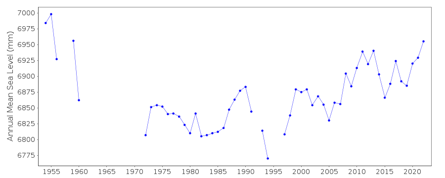
| Time span of data: | 1954 – 2022 |
| Completeness (%): | 83 |
| Date of last update: | 24 Apr 2023 |
| Green Arrow: | Current Station |
| Yellow Marker: | Neighbouring RLR Station |
| Red Marker: | Neighbouring Metric Station |
Please note: In many cases, the station position in our database is accurate to only one minute. Thus, the tide gauge may not appear to be on the coast.
Tide Gauge Data
Additional Data Sources (guide to additional data sources)
Research Quality Data from UHSLC station 321: hourly and dailyStation Documentation
Link to RLR information.Documentation - date unknown
1954 - 1961 Data supplied by the British Hydrographic Dept.Documentation added 1991-06-11
Sembawang 555/051 RLR(1955) is 9.9m below TGBMDocumentation added 2010-10-12
ACD 1954-1985 is 4.892m below TGBM. ACD 1986 onwards is 4.923m below TGBM. RLR (1955) is 9.9m below TGBM.Data Authority
Maritime Port Authority of SingaporeHydrographic Department
460 Alexandra Road, PSA Building
#20-00 Singapore 119963

![]()
![]()
![]()
