Data
- Obtaining
- Supplying
- High-Frequency
- Bottom Pressure Records
- Other Long Records
- GLOSS/ODINAFRICA Calibration Data
Donate
Donate to PSMSL
Data Notes
- Individual Station Data and Plot Notes
- Referencing the Data Set
- PSMSL Help File
- 2010 Changes to the PSMSL Data Files
Extracted from Database
11 Mar 2024
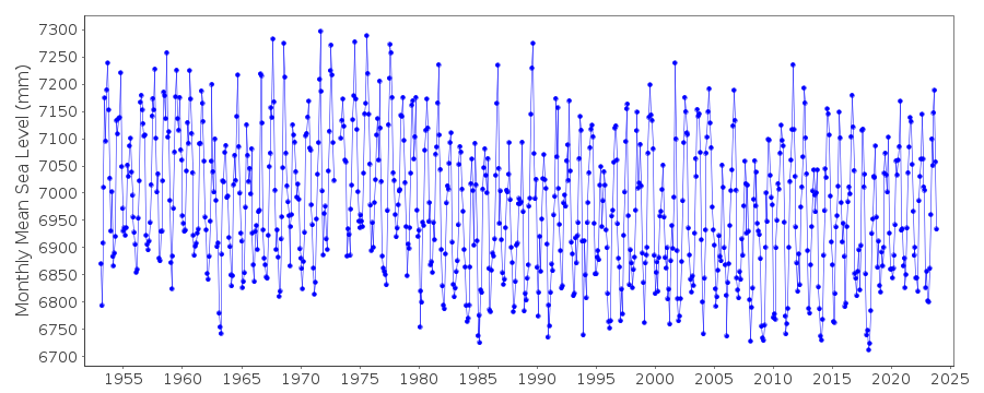
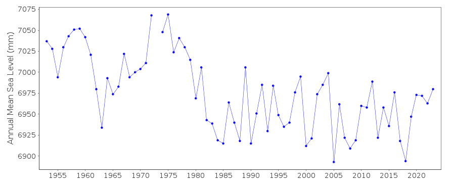
Station Information
| Station ID: | 701 |
| Latitude: | 34.144167 |
| Longitude: | 135.191389 |
| Coastline code: | 643 |
| Station code: | 13 |
| Country: | JAPAN |
| Time span of data: | 1953 – 2023 |
| Completeness (%): | 99 |
| Link to ellipsoid: | Available |
| Date of last update: | 04 Mar 2024 |
| Green Arrow: | Current Station |
| Yellow Marker: | Neighbouring RLR Station |
| Red Marker: | Neighbouring Metric Station |
Please note: In many cases, the station position in our database is accurate to only one minute. Thus, the tide gauge may not appear to be on the coast.
Tide Gauge Data
Station Documentation
Link to RLR information.Documentation added 1991-06-11
Kainan 643/013 RLR(1974) is 10.2m below BM Attach-14Documentation added 2009-11-17
The relevant authority for this station is the Geographical Survey Institute. For some reason the data for 1998 was not downloaded from this authority. Data downloaded and entered 17.11.09.Documentation added 2011-02-22
Sea Level profile for Kainan compares very well when buddy checked with that for Wakayama.Documentation added 2012-02-21
A massive earthquake magnitude 9.0 occurred at 14:46 JST (05:46 UTC) on Friday 11th March 2011 with the epicenter approx. 70km east of the Oshika Peninsula of Tohoku. It was the most powerful known earthquake to hit Japan and triggered a tsunami with waves of up to 40.5m and travelling 10km inland.Documentation added 2014-03-13
The GPS benchmark information has been downloaded from the SONEL website. GPS benchmark is P117 14.502m above RLR.Data Authority
Geographical Survey InstituteKitasato -1
Tsukuba-shi
Ibaraki-ken 305

![]()
![]()
![]()
