Data
- Obtaining
- Supplying
- High-Frequency
- Bottom Pressure Records
- Other Long Records
- GLOSS/ODINAFRICA Calibration Data
Donate
Donate to PSMSL
Data Notes
- Individual Station Data and Plot Notes
- Referencing the Data Set
- PSMSL Help File
- 2010 Changes to the PSMSL Data Files
Extracted from Database
11 Mar 2024
Station Information
| Station ID: | 439 |
| Latitude: | -9.483333 |
| Longitude: | 147.133333 |
| Coastline code: | 670 |
| Station code: | 11 |
| Country: | PAPUA NEW GUINEA |
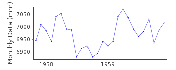
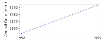
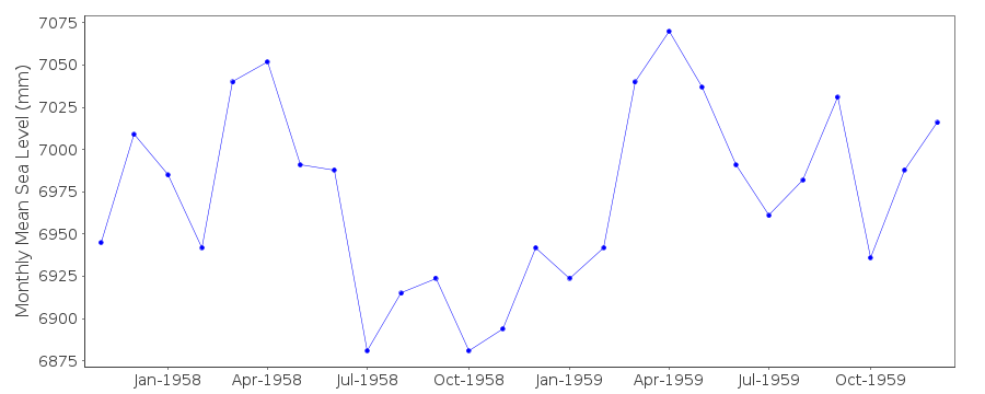
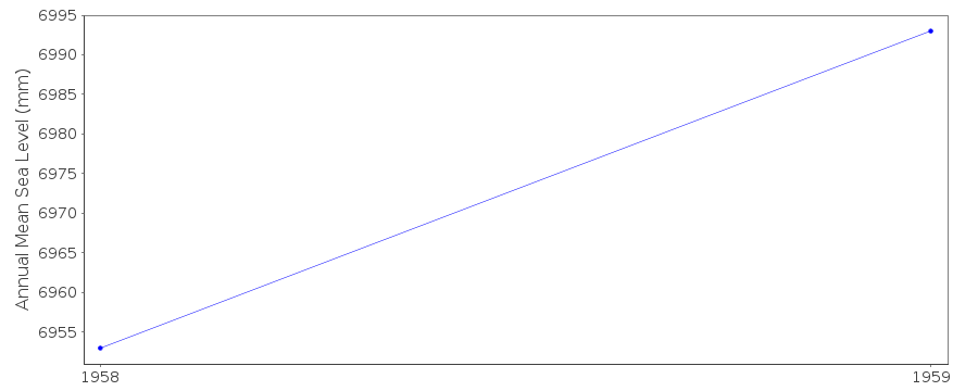
| Time span of RLR data: | 1957 – 1959 |
| RLR completeness (%): | 72 |
| Time span of metric data: | 1939 – 1979 |
| Metric completeness (%): | 14 |
| Date of last update: | 20 May 1996 |
| Green Arrow: | Current Station |
| Yellow Marker: | Neighbouring RLR Station |
| Red Marker: | Neighbouring Metric Station |
Please note: In many cases, the station position in our database is accurate to only one minute. Thus, the tide gauge may not appear to be on the coast.
Tide Gauge Data
Additional Data Sources (guide to additional data sources)
Nearby GNSS Stations from SONEL: MOREResearch Quality Data from UHSLC station 64: hourly and daily
Station Documentation
Link to RLR information.Documentation added 1991-06-11
Port Moresby 670/011 RLR(1959) is 9.0m below BM WaterfrontDocumentation added 1996-05-03
Data for 1970 onwards was revised in May 1996Data Authority
National Tidal CentreBureau of Meteorology
PO Box 421
Kent Town 5071
South Australia
Documentation added 2010-08-12
Formerly known as the National Tidal Facility

![]()
![]()
![]()
