Data
- Obtaining
- Supplying
- High-Frequency
- Bottom Pressure Records
- Other Long Records
- GLOSS/ODINAFRICA Calibration Data
Donate
Donate to PSMSL
Data Notes
- Individual Station Data and Plot Notes
- Referencing the Data Set
- PSMSL Help File
- 2010 Changes to the PSMSL Data Files
Extracted from Database
11 Mar 2024
Station Information
| Station ID: | 289 |
| Latitude: | 54.95 |
| Longitude: | 20.216667 |
| GLOSS ID: | 97 |
| Coastline code: | 80 |
| Station code: | 181 |
| Country: | RUSSIAN FEDERATION |
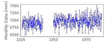
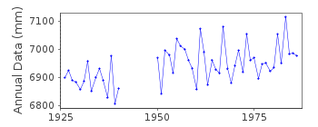
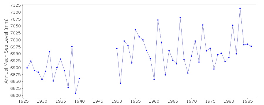
| Time span of data: | 1926 – 1986 |
| Completeness (%): | 86 |
| Date of last update: | 29 Jun 1988 |
| Green Arrow: | Current Station |
| Yellow Marker: | Neighbouring RLR Station |
| Red Marker: | Neighbouring Metric Station |
Please note: In many cases, the station position in our database is accurate to only one minute. Thus, the tide gauge may not appear to be on the coast.
Tide Gauge Data
Station Documentation
Link to RLR information.Documentation added 1991-06-11
Kaliningrad 080/181 RLR(1964) is 9.5m below BMDocumentation added 1994-07-11
This station is in Russia. It was part of Germany before World War II.Documentation added 2018-01-16
This station was previously called Kaliningrad. However, the co-ordinates have now been verified by the World Data Center (WDC) that this position is actually PionerskyData Authority
World Data CenterRussian Federal Service for Hydrometeorology
and Environmental Monitoring
6 Korolev Street, 249035 Obninsk
Kaluga Region

![]()
![]()
![]()
