Data
- Obtaining
- Supplying
- High-Frequency
- Bottom Pressure Records
- Other Long Records
- GLOSS/ODINAFRICA Calibration Data
Donate
Donate to PSMSL
Data Notes
- Individual Station Data and Plot Notes
- Referencing the Data Set
- PSMSL Help File
- 2010 Changes to the PSMSL Data Files
Extracted from Database
11 Mar 2024
Station Information
| Station ID: | 21 |
| Latitude: | 57.15 |
| Longitude: | -2.083333 |
| Coastline code: | 170 |
| Station code: | 12 |
| Country: | UNITED KINGDOM |
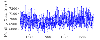
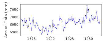
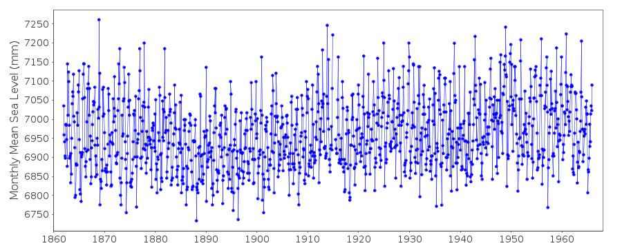
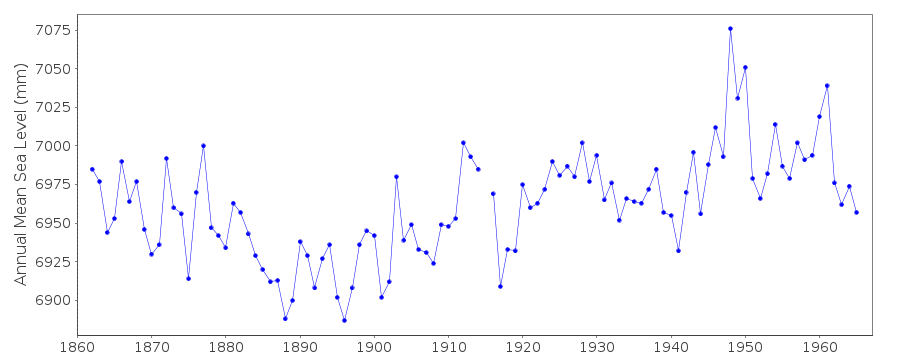
| Time span of data: | 1862 – 1965 |
| Completeness (%): | 100 |
| Link to ellipsoid: | Available |
| Date of last update: | 01 Jan 1980 |
| Green Arrow: | Current Station |
| Yellow Marker: | Neighbouring RLR Station |
| Red Marker: | Neighbouring Metric Station |
Please note: In many cases, the station position in our database is accurate to only one minute. Thus, the tide gauge may not appear to be on the coast.
Tide Gauge Data
Additional Data Sources (guide to additional data sources)
Nearby GNSS Stations from SONEL: ABERNearby Real Time Stations from VLIZ: abed
Station Documentation
Link to RLR information.Documentation added 1991-06-11
Aberdeen II 170/012 RLR(1965) is 10.4m below TGBM NJ9558 0581Documentation added 1993-07-12
Aberdeen II 170/012 RLR(1965) is 10.4m below TGBM NJ9558 0581Documentation added 1995-08-16
The two Aberdeen records are because one (170/011) is MSL and theother (170/012) is MTL (Mean Tide Level). There is a systematic 14 mm
difference in datum between the two which can be determined from
the period of overlap - see 'Trends in UK mean sea level' by
P.L.Woodworth, Marine Geodesy, 11, 57-87, 1987.
Documentation added 1996-11-25
Correspondence between MSL and MTL (series 170/011 and 170/012)is poor around 1948 because of many missing days.
Documentation added 2001-01-02
Recent work on vertical land movements in the UK can be found fromthe University of Nottingham web site:
http://ukcogr.iessg.nottingham.ac.uk/~eosi/
Data Authority
Aberdeen Harbour Board16 Regent Quay
Aberdeen

![]()
![]()
![]()
