Data
- Obtaining
- Supplying
- High-Frequency
- Bottom Pressure Records
- Other Long Records
- GLOSS/ODINAFRICA Calibration Data
Donate
Donate to PSMSL
Data Notes
- Individual Station Data and Plot Notes
- Referencing the Data Set
- PSMSL Help File
- 2010 Changes to the PSMSL Data Files
Extracted from Database
11 Mar 2024
Station Information
| Station ID: | 1733 |
| Latitude: | 5.983333 |
| Longitude: | 116.066667 |
| Coastline code: | 665 |
| Station code: | 31 |
| Country: | MALAYSIA |
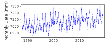
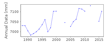
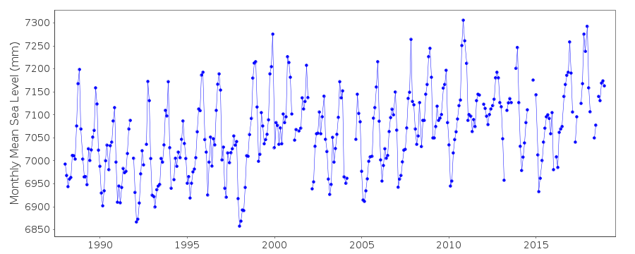
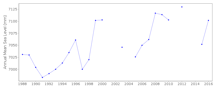
| Time span of data: | 1988 – 2018 |
| Completeness (%): | 92 |
| Date of last update: | 11 Sep 2019 |
| Green Arrow: | Current Station |
| Yellow Marker: | Neighbouring RLR Station |
| Red Marker: | Neighbouring Metric Station |
Please note: In many cases, the station position in our database is accurate to only one minute. Thus, the tide gauge may not appear to be on the coast.
Tide Gauge Data
Additional Data Sources (guide to additional data sources)
Nearby GNSS Stations from SONEL: UMSSResearch Quality Data from UHSLC station 386: hourly and daily
Station Documentation
Link to RLR information.Documentation added 1993-07-12
Kota Kinabalu 665/031 RLR(1988) is 10.7m below BM 2018Documentation added 2012-09-17
Publication Tidal Observation Records 2010 confirms the Primary benchmarkremains BM 2018 6.179m above TGZ.
Documentation added 2014-10-09
After querying the data value for March 2013 this value has been revised from 4.110m to 2.437m.Data Authority
Department of Survey and MappingWisma JUPEM
Jalan Semarak
50578 Kuala Lumpur

![]()
![]()
![]()
