Data
- Obtaining
- Supplying
- High-Frequency
- Bottom Pressure Records
- Other Long Records
- GLOSS/ODINAFRICA Calibration Data
Donate
Donate to PSMSL
Data Notes
- Individual Station Data and Plot Notes
- Referencing the Data Set
- PSMSL Help File
- 2010 Changes to the PSMSL Data Files
Extracted from Database
11 Mar 2024
Station Information
| Station ID: | 1696 |
| Latitude: | 26.611667 |
| Longitude: | -80.033333 |
| Coastline code: | 960 |
| Station code: | 4 |
| Country: | UNITED STATES |
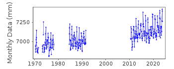
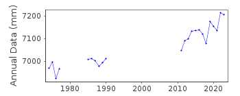
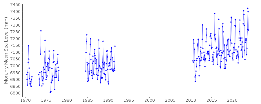
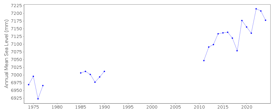
| Time span of data: | 1970 – 2023 |
| Completeness (%): | 49 |
| Date of last update: | 10 Jan 2024 |
| Green Arrow: | Current Station |
| Yellow Marker: | Neighbouring RLR Station |
| Red Marker: | Neighbouring Metric Station |
Please note: In many cases, the station position in our database is accurate to only one minute. Thus, the tide gauge may not appear to be on the coast.
Tide Gauge Data
Station Documentation
Link to RLR information.Documentation added 1991-06-11
Lake Worth Pier 960/004 RLR(1986) is 11.9m below BM Q317 1970Documentation added 2012-02-16
Lake Worth Pier is now an Historic station. Last data received was that for 1988. Although it still features on the NOAA website the documentation is no longer relevant.Documentation added 2017-02-07
It looks possible that a new tide gauge has been installed at Lake Worth Pier additional historic data is also available. All the data for this station has been loaded onto the database. As there is no bench mark information the station cannot be made RLR.Data Authority
N.O.A.A. / N.O.S.N/oes33, Ssmc4, Room 6531
1305 East-West Highway
Silver Spring,
MD 20910

![]()
![]()
![]()
