Data
- Obtaining
- Supplying
- High-Frequency
- Bottom Pressure Records
- Other Long Records
- GLOSS/ODINAFRICA Calibration Data
Donate
Donate to PSMSL
Data Notes
- Individual Station Data and Plot Notes
- Referencing the Data Set
- PSMSL Help File
- 2010 Changes to the PSMSL Data Files
Extracted from Database
11 Mar 2024
Station Information
| Station ID: | 1673 |
| Latitude: | -20.15 |
| Longitude: | 57.5 |
| GLOSS ID: | 18 |
| Coastline code: | 450 |
| Station code: | 12 |
| Country: | MAURITIUS |
| Time span of data: | 1986 – 2023 |
| Completeness (%): | 95 |
| Date of last update: | 15 May 2023 |
| Green Arrow: | Current Station |
| Yellow Marker: | Neighbouring RLR Station |
| Red Marker: | Neighbouring Metric Station |
Please note: In many cases, the station position in our database is accurate to only one minute. Thus, the tide gauge may not appear to be on the coast.
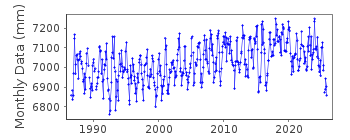
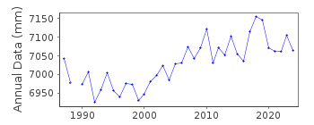
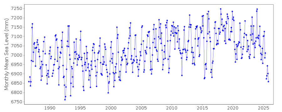
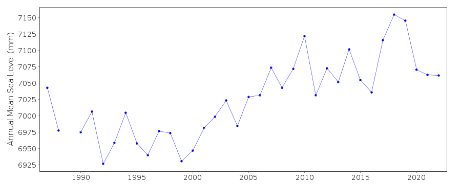
Tide Gauge Data
Additional Data Sources (guide to additional data sources)
Nearby GNSS Stations from SONEL: VACSNearby Real Time Stations from VLIZ: ptlu
Fast Delivery Data from UHSLC station 103: hourly and daily
Research Quality Data from UHSLC station 103: hourly and daily
Station Documentation
Link to RLR information.Documentation added 1993-07-12
Port Louis II 450/012 RLR(1988) is 8.8m below TGBM Brass BoltDocumentation added 1996-02-09
data received from TOGA centre RLR revised following new data and datum, BM detailsDocumentation added 1996-10-15
instrument type: analog (LS); digital (ENC/ENB) Leupold and Stevens (LS), model A-71, Handar 436-A, Encoder (ENC), Handar 436-B (ENB); all float gauges *primary gauge LS (1986-92), ENC (1993-)Documentation added 2012-08-08
Data for Port Louis continues to be supplied by the Marine Section of the Mauritius Meteorological Services.Data Authority
Meteorological ServicesMeteorological Services Headquarters
St. Paul Road
Vacoas

![]()
![]()
![]()
