Data
- Obtaining
- Supplying
- High-Frequency
- Bottom Pressure Records
- Other Long Records
- GLOSS/ODINAFRICA Calibration Data
Donate
Donate to PSMSL
Data Notes
- Individual Station Data and Plot Notes
- Referencing the Data Set
- PSMSL Help File
- 2010 Changes to the PSMSL Data Files
Extracted from Database
11 Mar 2024
Station Information
| Station ID: | 1603 |
| Latitude: | -62.483333 |
| Longitude: | -59.633333 |
| GLOSS ID: | 189 |
| Coastline code: | 999 |
| Station code: | 5 |
| Country: | ANTARCTICA |
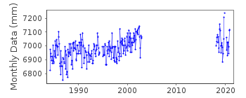
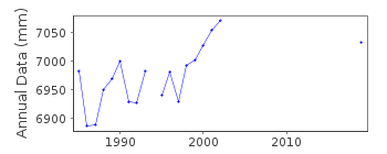
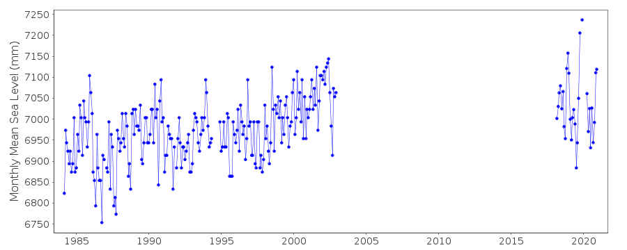
| Time span of data: | 1984 – 2020 |
| Completeness (%): | 56 |
| Date of last update: | 10 Oct 2022 |
| Green Arrow: | Current Station |
| Yellow Marker: | Neighbouring RLR Station |
| Red Marker: | Neighbouring Metric Station |
Please note: In many cases, the station position in our database is accurate to only one minute. Thus, the tide gauge may not appear to be on the coast.
Tide Gauge Data
Additional Data Sources (guide to additional data sources)
Nearby Real Time Stations from VLIZ: prat, prat3Fast Delivery Data from UHSLC station 730: hourly and daily
Research Quality Data from UHSLC station 730: hourly and daily
Station Documentation
Link to RLR information.Documentation added 1998-05-20
gauge type: pneumatic bubblerDocumentation added 2003-09-17
The base at Puerto Soberania is operated by the Chilean Navy and is called Base Prat.Documentation added 2004-10-20
Data for the period 1983-97 were replaced by a new data set received from Chilean authority SHOA.Documentation added 2012-08-13
Puerto Soberania is an historic station and has been labelled 'inactive'.Documentation added 2020-08-26
Puerto Soberania was re-instated in March 2018Data Authority
Hydrographic and Oceanographic Service of the Chilean NavyErrazuriz 254
Playa Ancha
Valparaiso

![]()
![]()
![]()
