Data
- Obtaining
- Supplying
- High-Frequency
- Bottom Pressure Records
- Other Long Records
- GLOSS/ODINAFRICA Calibration Data
Donate
Donate to PSMSL
Data Notes
- Individual Station Data and Plot Notes
- Referencing the Data Set
- PSMSL Help File
- 2010 Changes to the PSMSL Data Files
Extracted from Database
11 Mar 2024
Station Information
| Station ID: | 159 |
| Latitude: | 43.216667 |
| Longitude: | 140.866667 |
| Coastline code: | 641 |
| Station code: | 41 |
| Country: | JAPAN |
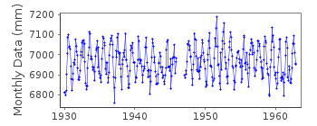
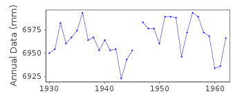
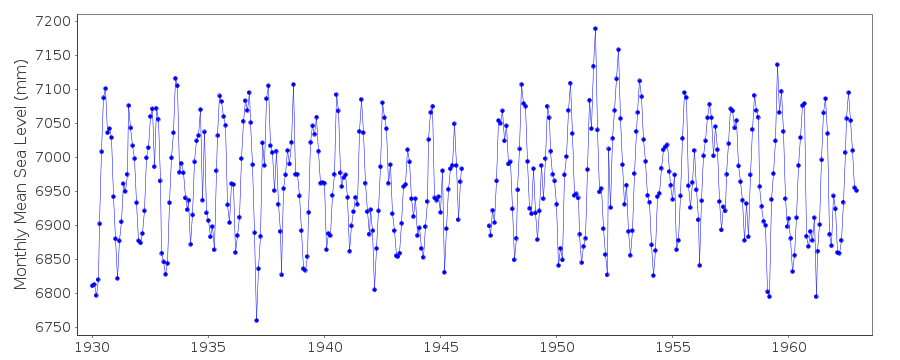
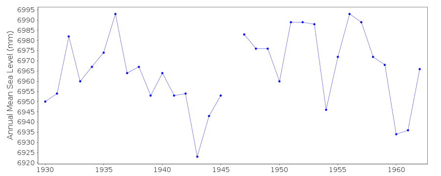
| Time span of RLR data: | 1930 – 1962 |
| RLR completeness (%): | 97 |
| Time span of metric data: | 1906 – 1962 |
| Metric completeness (%): | 98 |
| Link to ellipsoid: | Available |
| Date of last update: | 01 Jan 1980 |
| Green Arrow: | Current Station |
| Yellow Marker: | Neighbouring RLR Station |
| Red Marker: | Neighbouring Metric Station |
Please note: In many cases, the station position in our database is accurate to only one minute. Thus, the tide gauge may not appear to be on the coast.
Tide Gauge Data
Station Documentation
Link to RLR information.Documentation added 1991-06-11
Oshoro I 641/041 RLR(1962) is 9.0m below BM No9Oshoro I is an historic station last data 1962
Documentation added 1995-08-29
A destructive earthquake and tsunami occurred in the Kuril Islands on 4 October 1994 - see Earth System Monitor, 5(4), June 1995.Data Authority
Geographical Survey InstituteKitasato -1
Tsukuba-shi
Ibaraki-ken 305

![]()
![]()
![]()
