Data
- Obtaining
- Supplying
- High-Frequency
- Bottom Pressure Records
- Other Long Records
- GLOSS/ODINAFRICA Calibration Data
Donate
Donate to PSMSL
Other Links
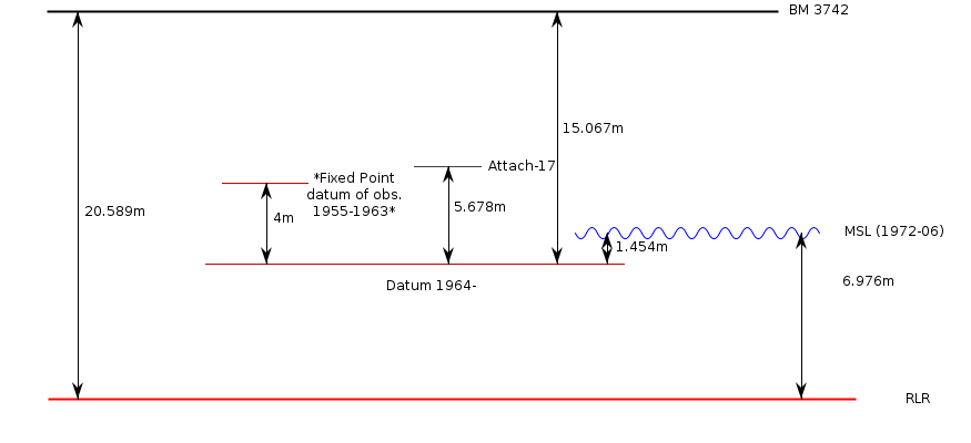
Revised Local Reference (RLR) Diagram for KASHIWAZAKI
Station ID: 753

If the image above appears blurry, or you would like to see a larger image, please view the full-sized image of the RLR diagram.
Datum information
Add 9.522m to data values 1955-1963 to refer to RLR
Add 5.522m to data values 1964 onwards to refer to RLR
RLR is 20.589m below primary benchmark BM 3742
Ellipsoidal information from SONEL (explanation)
| GNSS | Solution | Height | Velocity | Epoch | GNSS Start | GNSS End | Distance |
|---|---|---|---|---|---|---|---|
| P110 | NGL14 | 32.173 ± 0.004 | 4.72 ± 1.07 | 2020.0000 | 2003-06-25 | 2023-03-23 | 62 |
| P110 | GT3 | 32.279 ± 0.005 | 7.97 ± 0.30 | 2020.0000 | 2003-06-25 | 2023-03-23 | 62 |


