Data
- Obtaining
- Supplying
- High-Frequency
- Bottom Pressure Records
- Other Long Records
- GLOSS/ODINAFRICA Calibration Data
Donate
Donate to PSMSL
Other Links
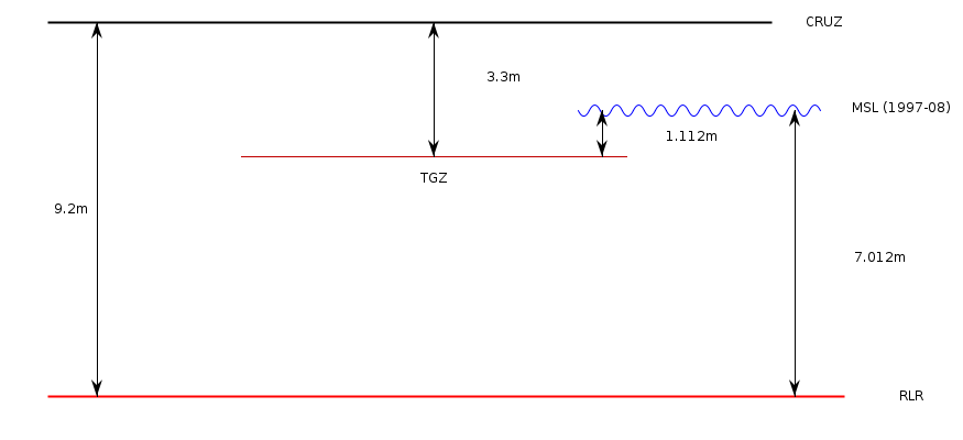
Revised Local Reference (RLR) Diagram for TARIFA
Station ID: 488

If the image above appears blurry, or you would like to see a larger image, please view the full-sized image of the RLR diagram.
Datum information
Add 5.900m to all data values to refer to RLR
RLR is 9.200m below primary benchmark CRUZ
Ellipsoidal information from SONEL (explanation)
| GNSS | Solution | Height | Velocity | Epoch | GNSS Start | GNSS End | Distance |
|---|---|---|---|---|---|---|---|
| TARI | NGL14 | 34.689 ± 0.007 | 2.09 ± 1.05 | 2020.0000 | 2010-05-15 | 2019-05-30 | 10 |


