Data
- Obtaining
- Supplying
- High-Frequency
- Bottom Pressure Records
- Other Long Records
- GLOSS/ODINAFRICA Calibration Data
Donate
Donate to PSMSL
Other Links
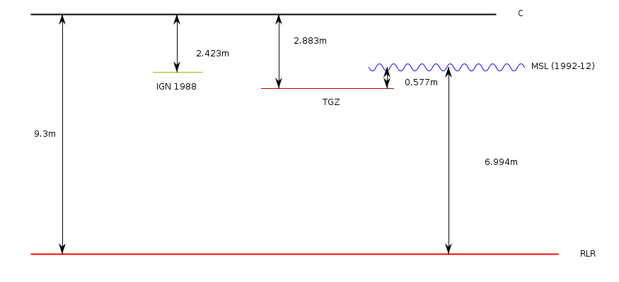
Revised Local Reference (RLR) Diagram for POINTE-A-PITRE
Station ID: 1784

If the image above appears blurry, or you would like to see a larger image, please view the full-sized image of the RLR diagram.
Datum information
Add 6.417m to all data values to refer to RLR
RLR is 9.300m below primary benchmark C
Ellipsoidal information from SONEL (explanation)
| GNSS | Solution | Height | Velocity | Epoch | GNSS Start | GNSS End | Distance |
|---|---|---|---|---|---|---|---|
| PPTG | ULR7a | -47.375 ± 0.011 | -0.63 ± 0.33 | 2020.0000 | 2015-11-25 | 2023-03-23 | 28 |
| PPTG | NGL14 | -47.369 ± 0.006 | 0.05 ± 1.60 | 2020.0000 | 2015-11-25 | 2023-03-23 | 28 |


