Data
- Obtaining
- Supplying
- High-Frequency
- Bottom Pressure Records
- Other Long Records
- GLOSS/ODINAFRICA Calibration Data
Donate
Donate to PSMSL
Data Notes
- Individual Station Data and Plot Notes
- Referencing the Data Set
- PSMSL Help File
- 2010 Changes to the PSMSL Data Files
Extracted from Database
11 Mar 2024
WARNING: QCFLAG EXISTS. PLEASE READ THE DOCUMENTATION.
Station Information
| Station ID: | 2266 |
| Latitude: | 16.465 |
| Longitude: | 97.621667 |
| GLOSS ID: | 141 |
| Coastline code: | 530 |
| Station code: | 22 |
| Country: | MYANMAR |
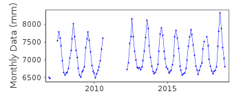
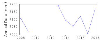
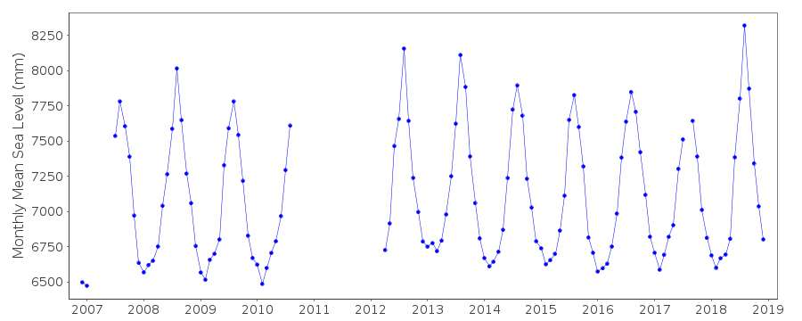
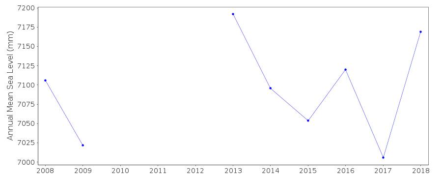
| Time span of data: | 2006 – 2018 |
| Completeness (%): | 77 |
| Date of last update: | 07 Mar 2023 |
| Green Arrow: | Current Station |
| Yellow Marker: | Neighbouring RLR Station |
| Red Marker: | Neighbouring Metric Station |
Please note: In many cases, the station position in our database is accurate to only one minute. Thus, the tide gauge may not appear to be on the coast.
Tide Gauge Data
Additional Data Sources (guide to additional data sources)
Fast Delivery Data from UHSLC station 906: hourly and dailyResearch Quality Data from UHSLC station 906: hourly and daily
Station Documentation
Link to RLR information.Documentation added 2015-09-23
Moulmein II is a new station. Data is from a UH gauge and is part of the JASL dataset. The station cannot currently be made RLR as there is no stable benchmark.Data Authority
University of HawaiiDepartment of Oceanography Division of Natural Sciences
1000 Pope Road
Honolulu
Hawaii 96822

![]()
![]()
![]()
