Data
- Obtaining
- Supplying
- High-Frequency
- Bottom Pressure Records
- Other Long Records
- GLOSS/ODINAFRICA Calibration Data
Donate
Donate to PSMSL
Data Notes
- Individual Station Data and Plot Notes
- Referencing the Data Set
- PSMSL Help File
- 2010 Changes to the PSMSL Data Files
Extracted from Database
11 Mar 2024
Station Information
| Station ID: | 1885 |
| Latitude: | 37.733333 |
| Longitude: | -25.666667 |
| GLOSS ID: | 245 |
| Coastline code: | 360 |
| Station code: | 2 |
| Country: | PORTUGAL |
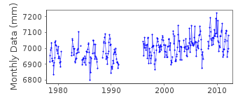
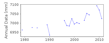
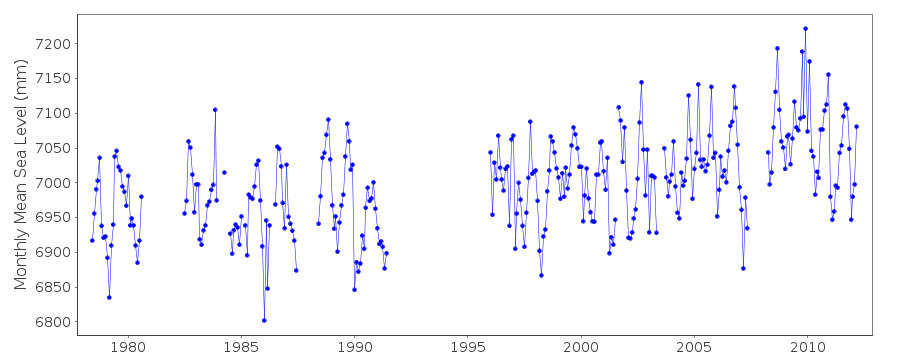
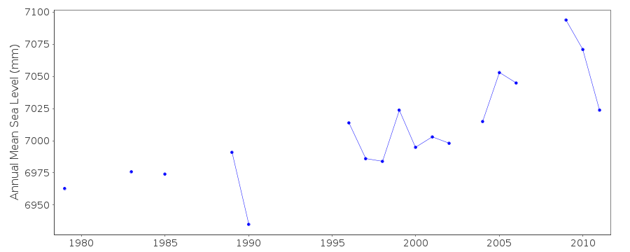
| Time span of data: | 1978 – 2012 |
| Completeness (%): | 71 |
| Date of last update: | 07 Mar 2023 |
| Green Arrow: | Current Station |
| Yellow Marker: | Neighbouring RLR Station |
| Red Marker: | Neighbouring Metric Station |
Please note: In many cases, the station position in our database is accurate to only one minute. Thus, the tide gauge may not appear to be on the coast.
Tide Gauge Data
Additional Data Sources (guide to additional data sources)
Nearby Real Time Stations from VLIZ: pdasFast Delivery Data from UHSLC station 211: hourly and daily
Research Quality Data from UHSLC station 211: hourly and daily
Station Documentation
Link to RLR information.Documentation added 2006-07-07
Data 1996-on are from the University of Hawaii Sea Level CenterDocumentation added 2013-10-15
Complete UHSLC dataset 1978-2012 added to 'Metric' seriesData Authority
N.O.A.A. / N.O.S.N/oes33, Ssmc4, Room 6531
1305 East-West Highway
Silver Spring,
MD 20910

![]()
![]()
![]()
